

Tomorrow's system will hug the coast, split and head south. Moisture tap will be extremely light so only expecting scattered snow showers in the mountains and a shower or two sneaking down to the valley.

Another weak system will move through Monday. This is more of a hybrid slider system that will likely bring more wind than rain for most of the Northstate. The backside of the storm will be a north to south jet axis, that will tighten the surface pressure gradient. Expect a slight breeze out of the north.

And again another weak system Wednesday evening that will likely hug the coast and dip south. 3 very weak systems that are all starved for moisture over the next 7 days.

After what seemed like an eternity. the Pacific North American index (teleconnection we look at for blocking in the North Central Pacific) finally went positive after a month and a half negative. Due to less blocking, big powerful troughs are unable to be nudged down from the Gulf of Alaska to the Northstate.
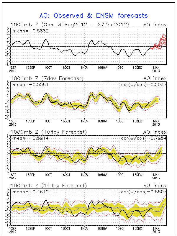
The Arctic Oscillation continues to push positive and looks to remain positive through the extended period. AO is a slight measure of how wavy and troughy the jet stream is. The more negative the more rosby waves can build up on the jet stream, bringing us a better shot at big storms.

And finally the Madden Julian Oscillation continues to be nonexistent. A very low amplitude wave that is forecasted to meander in the Phase 4/5, which is unfavorable pattern for West Coast storms. So for now things quiet down.
No comments:
Post a Comment