First of all this is a fairly weak system so total precipitation is fairly low. But for the mountains rain-to-snow ratios will be high so snow can add up with little moisture to work with.
Lets set the stage.

(clear skies with clouds approaching from the west at 5:30 am Sat. morning)

(thick clouds in place by 8:00 am Sat. morning)
These clouds will then lock in a lot of cold/dense air in place
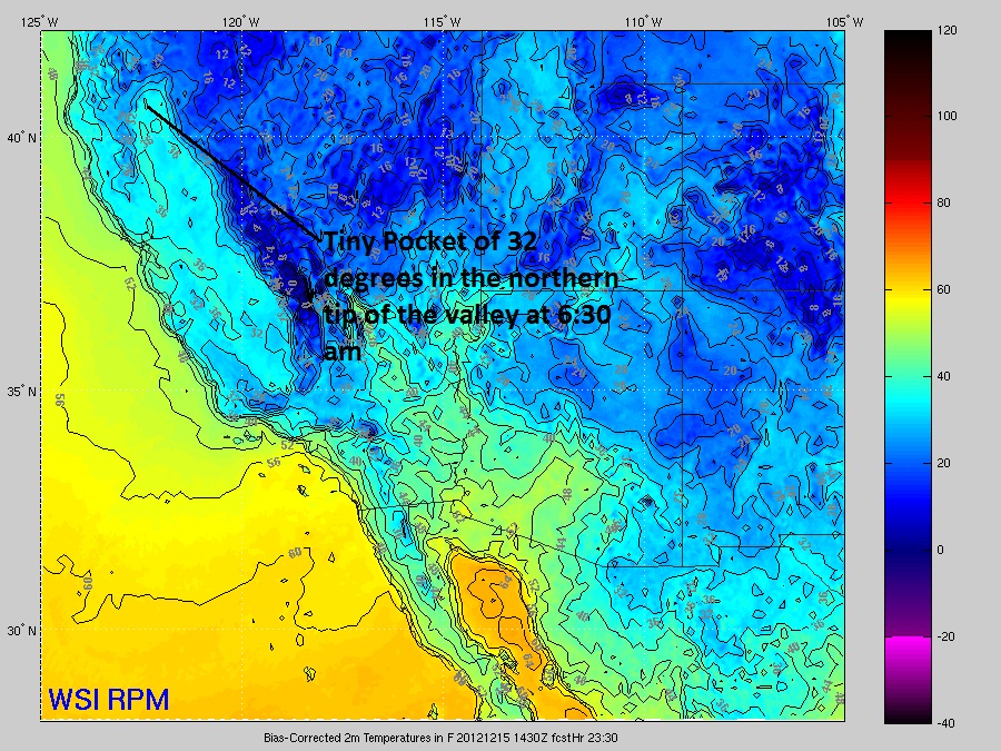
As of 6:30 am you can see most of the Northern Tip of the valley (Red Bluff and north) between 32-35 degrees.
Lets take a look at the upper levels.

(forecast skew-t sounding of Redding at 10:00 am Sat. from GFS model)
The first thing you will notice is the surface air temperature is slightly above freezing, right around 34 to 35 degrees. Next thing you'll notice is that the surface air column is very dry. You have to go up to about 700 mb (nearly 10,000ft altitude) before you get saturation. ***I will note that the GFS is much slower with the precipitation than other models. SO with this dry air in place we will receive cooling from evaporation as precipitation falls into the dry air column. We will also get slight cooling as snowflakes fall into this column. As the snow flakes melt, it cools the air-mass, kind of like dropping ice cubes into a room-temperature glass of water. Heat is pulled out of the glass of water to melt the ice cubes (exothermic reaction)

At 10:00 am you can see snow moving into most of the foothills and mountains.

By 11:00 am precipitation has made it down to the rest of the valley.
At this time most if not all of the snow should stay around 1000ft but it is possible we could get a few hours of snow in northern most tip of the valley floor, including Redding.
This is a warm advection rain event so as precipitation continues the air column will slowly warm. This will eventually raise the snow levels to above 1000ft as event prolongs. Overriding precipitation events over cold air damming are extremely tough to forecast and we will continue to monitor snow levels through the next 36 hours.

(accumulated snowfall through 7:00am Monday)
Heaviest accumulations remain above 3,000 ft with this weekend's system.
I expect a Winter Weather Advisory to be issued by the NWS sometime later today.
Rob
No comments:
Post a Comment